Madison elevation
Madison (Wisconsin, Dane County), United States elevation is 272 meters and Madison elevation in feet is 892 ft above sea level [src 1]. Madison is a seat of a first-order administrative division (feature code) with elevation that is 7 meters (23 ft) smaller than average city elevation in United States.
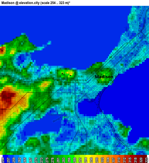
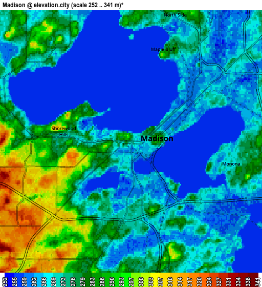
Below is the Elevation map of Madison, which displays elevation range with different colors. Scale of the first map is from 254 to 323 m (833 to 1060 ft) with average elevation of 265.4 meters (=871 ft) [note 1]
These maps also provides idea of topography and contour of this city, they are displayed at different zoom levels. More info about maps, scale and edge coordinates you can find below images.
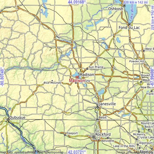
| \ | Map #1 | Map #2 | Topo.Map |
| Scale [m] | 254..323 m | 252..341 m | × |
| Scale [ft] | 833..1060 ft | 827..1119 ft | × |
| Average | 265.4 m = 871 ft | 272.6 m = 894 ft | × |
| Width | 7.14 km = 4.4 mi | 14.28 km = 8.9 mi | 228.4 km = 141.9 mi |
| Height | 7.14 km = 4.4 mi | 14.28 km = 8.9 mi | 228.4 km = 141.9 mi |
| ↑Max Latitude | 43.105143° | 43.137219° | 44.09168° |
| Latitude at center | 43.07305° | 43.07305° | 43.07305° |
| ↓Min Latitude | 43.04094° | 43.008814° | 42.03721° |
| ← Min Longitude | -89.445175° | -89.489121° | -90.80748° |
| Longitude center | -89.40123° | -89.40123° | -89.40123° |
| →Max Longitude | -89.357285° | -89.313339° | -87.99498° |
Nearby cities:
Cities around Madison sort by population:
• Sun Prairie elevation 291 m
19.6 km,  51°
51°
• Fitchburg 310 m
13.7 km,  204°
204°
• Middleton 291 m
8.8 km,  287°
287°
• Waunakee 285 m
13.9 km,  341°
341°
• Verona 298 m
14.1 km,  229°
229°
• Oregon 289 m
16.4 km,  175°
175°
• McFarland 266 m
11.3 km,  126°
126°
• Monona 272 m
5.6 km,  102°
102°
• Cottage Grove 270 m
16.4 km,  88°
88°
• Windsor 276 m
16.9 km,  16°
16°
• Shorewood Hills 277 m
3.6 km,  277°
277°
• Maple Bluff 274 m
5.3 km, 19°
Multilingual:
 En español:
Madison elevación 272 m.
 En France:
Madison élévation 272 m.


Sources and notes:
- [note 1] Map square and city borders are not equal. Map elevation data is calculated only from area inside that square.
- [src 1] Elevation data from geonames database provided with same terms of usage.
- [src 2] The elevation map of Madison is generated using elevation data from NASA's 3 arcsec (90m) resolution SRTM data.
- [src 3] Base (background) map © OpenStreetMap contributors tiles are generated by Geofabrik and OpenTopoMap.
Copyright & License:
This Madison Elevation Map is licensed under CC BY-SA. You may reuse any part from this page, if you give a proper credit by linking to this URL:
 More info on terms of use page.