Comitán elevation
Comitán (Chiapas, Comitán Municipality), Mexico elevation is 1632 meters and Comitán elevation in feet is 5354 ft above sea level [src 1]. Comitán is a seat of a second-order administrative division (feature code) with elevation that is 318 meters (1043 ft) bigger than average city elevation in Mexico.
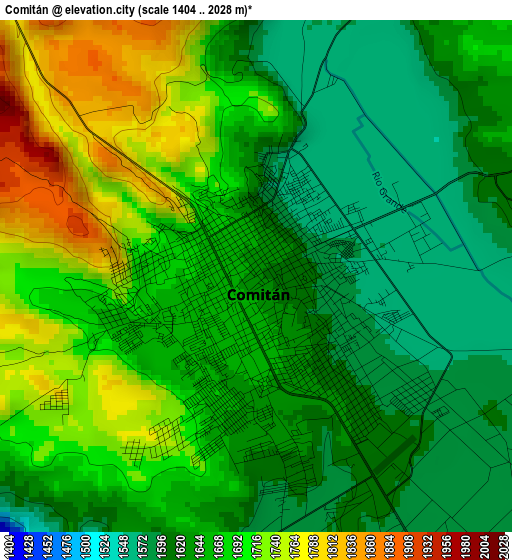
Below is the Elevation map of Comitán, which displays elevation range with different colors. Scale of the first map is from 1404 to 2028 m (4606 to 6654 ft) with average elevation of 1659.3 meters (=5444 ft) [note 1]
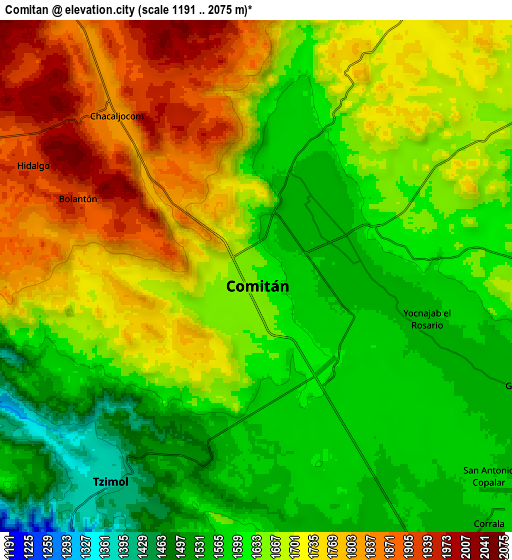
These maps also provides idea of topography and contour of this city, they are displayed at different zoom levels. More info about maps, scale and edge coordinates you can find below images.
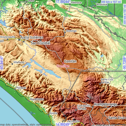
| \ | Map #1 | Map #2 | Topo.Map |
| Scale [m] | 1404..2028 m | 1191..2075 m | × |
| Scale [ft] | 4606..6654 ft | 3907..6808 ft | × |
| Average | 1659.3 m = 5444 ft | 1665.7 m = 5465 ft | × |
| Width | 9.38 km = 5.8 mi | 18.76 km = 11.7 mi | 300.2 km = 186.5 mi |
| Height | 9.38 km = 5.8 mi | 18.76 km = 11.7 mi | 300.2 km = 186.5 mi |
| ↑Max Latitude | 16.289286° | 16.331462° | 17.59244° |
| Latitude at center | 16.2471° | 16.2471° | 16.2471° |
| ↓Min Latitude | 16.204905° | 16.162701° | 14.89249° |
| ← Min Longitude | -92.179095° | -92.223041° | -93.5414° |
| Longitude center | -92.13515° | -92.13515° | -92.13515° |
| →Max Longitude | -92.091205° | -92.047259° | -90.7289° |
Nearby cities:
Cities around Comitán sort by population:
• Tzimol elevation 1382 m
9.1 km,  219°
219°
• La Independencia 1561 m
11.9 km,  87°
87°
• Villahermosa Yaluma 1728 m
11.4 km,  32°
32°
• San José Yocnajab 1600 m
5.2 km,  81°
81°
• Los Riegos 1589 m
6.5 km,  10°
10°
• Francisco Sarabia 1569 m
10.3 km,  161°
161°
• Cash 1594 m
4.4 km,  64°
64°
• Buenavista 1525 m
15.7 km, 91°
• Señor del Pozo 1611 m
6 km,  24°
24°
• Ochusjob 1422 m
12.7 km,  258°
258°
• Efraín A. Gutiérrez 1865 m
12.8 km,  327°
327°
• Chacaljocóm 1823 m
7.8 km,  318°
318°
Multilingual:
 En español:
Comitán elevación 1632 m.
 En France:
Comitán élévation 1632 m.
 Auf Deutsch:
Comitán höhe über dem Meeresspiegel ist 1632 m.
 На русском:
Комитан-де-Домингес высота над уровнем моря 1632 м
Sources and notes:
- [note 1] Map square and city borders are not equal. Map elevation data is calculated only from area inside that square.
- [src 1] Elevation data from geonames database provided with same terms of usage.
- [src 2] The elevation map of Comitán is generated using elevation data from NASA's 3 arcsec (90m) resolution SRTM data.
- [src 3] Base (background) map © OpenStreetMap contributors tiles are generated by Geofabrik and OpenTopoMap.
Copyright & License:
This Comitán Elevation Map is licensed under CC BY-SA. You may reuse any part from this page, if you give a proper credit by linking to this URL:
 More info on terms of use page.