Tiruchirappalli elevation
Tiruchirappalli (Tamil Nadu), India elevation is 79 meters and Tiruchirappalli elevation in feet is 259 ft above sea level [src 1]. Tiruchirappalli is a populated place (feature code) with elevation that is 214 meters (702 ft) smaller than average city elevation in India.
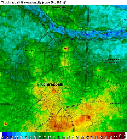
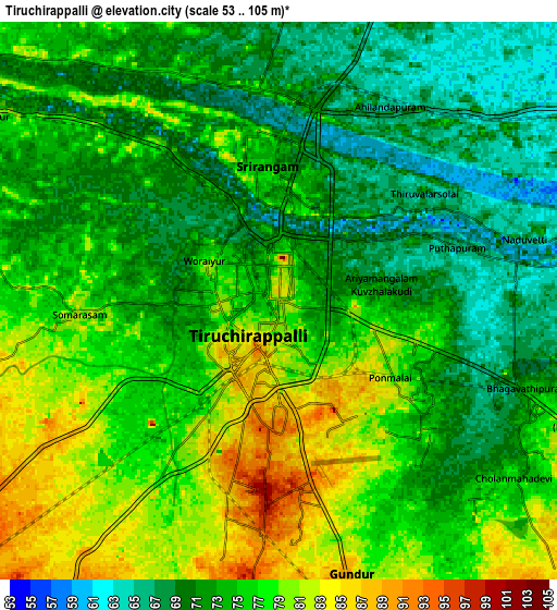
Below is the Elevation map of Tiruchirappalli, which displays elevation range with different colors. Scale of the first map is from 56 to 105 m (184 to 344 ft) with average elevation of 75.3 meters (=247 ft) [note 1]
These maps also provides idea of topography and contour of this city, they are displayed at different zoom levels. More info about maps, scale and edge coordinates you can find below images.

| \ | Map #1 | Map #2 | Topo.Map |
| Scale [m] | 56..105 m | 53..105 m | × |
| Scale [ft] | 184..344 ft | 174..344 ft | × |
| Average | 75.3 m = 247 ft | 74.5 m = 244 ft | × |
| Width | 9.6 km = 6 mi | 19.2 km = 11.9 mi | 307.1 km = 190.8 mi |
| Height | 9.6 km = 6 mi | 19.2 km = 11.9 mi | 307.2 km = 190.9 mi |
| ↑Max Latitude | 10.858662° | 10.901817° | 12.19346° |
| Latitude at center | 10.8155° | 10.8155° | 10.8155° |
| ↓Min Latitude | 10.772332° | 10.729158° | 9.43118° |
| ← Min Longitude | 78.652565° | 78.608619° | 77.29026° |
| Longitude center | 78.69651° | 78.69651° | 78.69651° |
| →Max Longitude | 78.740455° | 78.784401° | 80.10276° |
Nearby cities:
Cities around Tiruchirappalli sort by population:
• Manapparai elevation 167 m
37.5 km,  232°
232°
• Turaiyūr 146 m
38.7 km,  343°
343°
• Musiri 95 m
31.5 km,  299°
299°
• Kulittalai 87 m
33.7 km,  293°
293°
• Lalgudi 66 m
14.9 km,  64°
64°
• Vallam 80 m
41.1 km,  104°
104°
• Iluppūr 146 m
34.5 km,  193°
193°
• Thirukattupalli 50 m
28.6 km,  83°
83°
• Puliyūr 113 m
25.7 km,  141°
141°
• Pullambādi 65 m
27.2 km, 59°
• Kīranūr 108 m
29 km,  160°
160°
• Annavāsal 128 m
39.5 km,  179°
179°
Multilingual:
 En español:
Tiruchirappalli elevación 79 m.
 En France:
Tiruchirappalli élévation 79 m.
 Auf Deutsch:
Tiruchirappalli höhe über dem Meeresspiegel ist 79 m.

Sources and notes:
- [note 1] Map square and city borders are not equal. Map elevation data is calculated only from area inside that square.
- [src 1] Elevation data from geonames database provided with same terms of usage.
- [src 2] The elevation map of Tiruchirappalli is generated using elevation data from NASA's 3 arcsec (90m) resolution SRTM data.
- [src 3] Base (background) map © OpenStreetMap contributors tiles are generated by Geofabrik and OpenTopoMap.
Copyright & License:
This Tiruchirappalli Elevation Map is licensed under CC BY-SA. You may reuse any part from this page, if you give a proper credit by linking to this URL:
 More info on terms of use page.