Valladolid elevation
Valladolid (Castille and León, Provincia de Valladolid), Spain elevation is 702 meters and Valladolid elevation in feet is 2303 ft above sea level [src 1]. Valladolid is a seat of a first-order administrative division (feature code) with elevation that is 99 meters (325 ft) bigger than average city elevation in Spain.
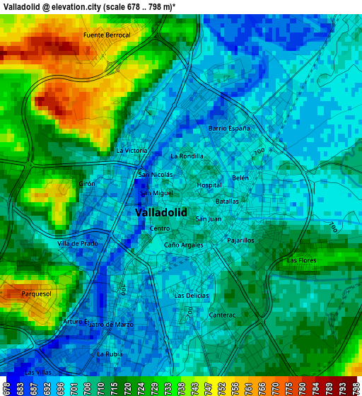
Below is the Elevation map of Valladolid, which displays elevation range with different colors. Scale of the first map is from 678 to 798 m (2224 to 2618 ft) with average elevation of 710.8 meters (=2332 ft) [note 1]
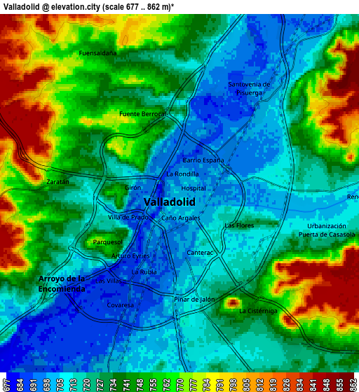
These maps also provides idea of topography and contour of this city, they are displayed at different zoom levels. More info about maps, scale and edge coordinates you can find below images.
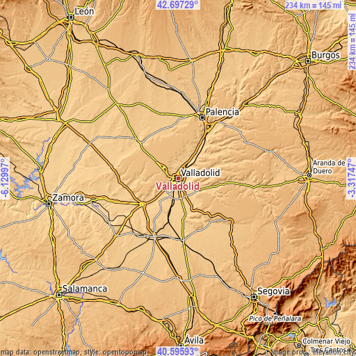
| \ | Map #1 | Map #2 | Topo.Map |
| Scale [m] | 678..798 m | 677..862 m | × |
| Scale [ft] | 2224..2618 ft | 2221..2828 ft | × |
| Average | 710.8 m = 2332 ft | 735.5 m = 2413 ft | × |
| Width | 7.3 km = 4.5 mi | 14.6 km = 9.1 mi | 233.6 km = 145.2 mi |
| Height | 7.3 km = 4.5 mi | 14.6 km = 9.1 mi | 233.6 km = 145.2 mi |
| ↑Max Latitude | 41.688006° | 41.720815° | 42.69729° |
| Latitude at center | 41.65518° | 41.65518° | 41.65518° |
| ↓Min Latitude | 41.622338° | 41.589478° | 40.59593° |
| ← Min Longitude | -4.767665° | -4.811611° | -6.12997° |
| Longitude center | -4.72372° | -4.72372° | -4.72372° |
| →Max Longitude | -4.679775° | -4.635829° | -3.31747° |
Nearby cities:
Cities around Valladolid sort by population:
• Laguna de Duero elevation 708 m
8.2 km,  179°
179°
• Arroyo de la Encomienda 691 m
7.9 km,  230°
230°
• Cistérniga 743 m
5.6 km,  146°
146°
• Simancas 720 m
11.2 km, 230°
• Cigales 749 m
11.6 km,  10°
10°
• Santovenia de Pisuerga 696 m
5.2 km,  32°
32°
• Cabezón 708 m
10.9 km,  36°
36°
• Zaratán 755 m
5 km,  275°
275°
• Villanubla 842 m
10.9 km,  296°
296°
• Fuensaldaña 749 m
6.6 km,  328°
328°
• Mucientes 755 m
10.2 km,  341°
341°
• Ciguñuela 817 m
11.2 km,  261°
261°
Multilingual:
 En español:
Valladolid elevación 702 m.
 En France:
Valladolid élévation 702 m.
 Auf Deutsch:
Valladolid höhe über dem Meeresspiegel ist 702 m.

Sources and notes:
- [note 1] Map square and city borders are not equal. Map elevation data is calculated only from area inside that square.
- [src 1] Elevation data from geonames database provided with same terms of usage.
- [src 2] The elevation map of Valladolid is generated using elevation data from NASA's 3 arcsec (90m) resolution SRTM data.
- [src 3] Base (background) map © OpenStreetMap contributors tiles are generated by Geofabrik and OpenTopoMap.
Copyright & License:
This Valladolid Elevation Map is licensed under CC BY-SA. You may reuse any part from this page, if you give a proper credit by linking to this URL:
 More info on terms of use page.